
Home About Services Projects Insights Contact Request a Quote Book a Consultation

Surveying & Geospatial Solutions for Property Development & Management Investments.

About the practice

Land data you can build a decision on.

OAS Geospatial Consults is a Lagos-based surveying and geospatial practice. We exist because too much land data in Nigeria is undocumented, disputed, or simply out of date — and every one of those gaps eventually becomes someone's problem at the worst possible time.

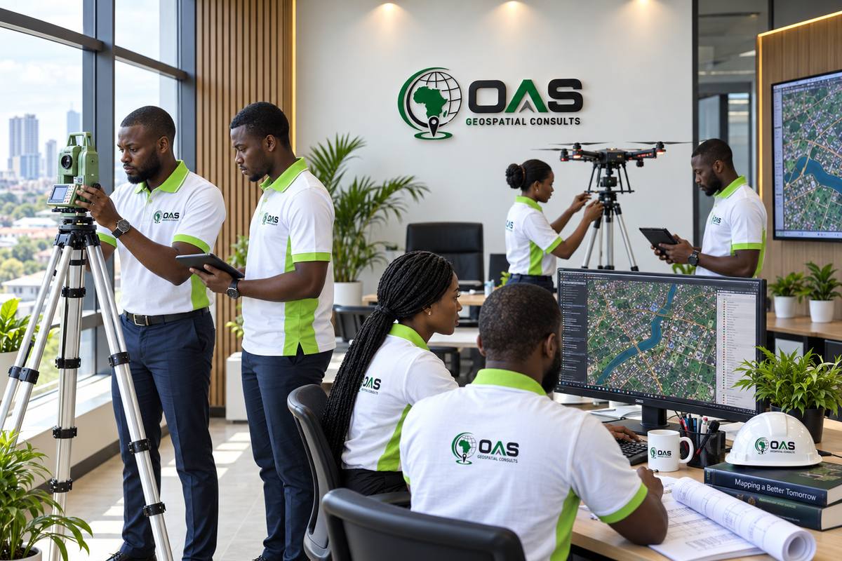
OAS Geospatial Consults field and GIS team at work in the office

Our Vision

To become a trusted African geomatics and geospatial consultancy with international relevance, recognised for transforming complex land, engineering and spatial challenges into reliable information that enables confident decisions and sustainable development.

Our Mission

To solve land, engineering and development challenges through precise surveying, intelligent geospatial solutions and professional technical expertise. We deliver reliable spatial information that supports planning, design, construction, property investment and infrastructure development for clients in Nigeria and beyond.

Why we exist

Precision Creates Confidence.
Reliable Data Protects Value.

Land, infrastructure and development decisions depend on accurate and dependable spatial information. OAS Geospatial Consults exists to reduce uncertainty by transforming field observations, geospatial data and technical analysis into reliable information for planning, design, construction, investment and asset management.

We combine professional surveying practice with modern geospatial technologies to help clients manage risk, make informed decisions and deliver projects with confidence.

What we start with
Field observations
Geospatial data
Technical analysis
Reliable information Verified and ready to rely on
What it supports
Planning
Design
Construction
Investment
Asset management

Professional & Technical Integrity

Every assignment is approached with appropriate survey control, verification, quality checks and professional judgement. Our work is prepared to meet relevant technical, professional and regulatory requirements, producing spatial information that clients can rely on.

Spatial Data With Lasting Value

We structure survey and geospatial information for continued use beyond a single drawing or report. Where appropriate, project data can support GIS, engineering design, construction, asset management and future development decisions.

Professional Trust

Built on Professional Expertise. Driven by Precision.

Reliable geospatial information carries professional responsibility. From land and engineering projects to construction, infrastructure and spatial planning, clients depend on accurate measurements, sound professional judgement and technically robust deliverables. OAS Geospatial Consults combines professional expertise, disciplined survey practice and modern geospatial technologies to deliver information that can be trusted throughout the project lifecycle.

Professional Expertise

Qualified & Responsible Practice

Our work is guided by professional judgement, technical competence and a clear understanding of the responsibilities attached to surveying, geomatics and geospatial information.

Multidisciplinary

Integrated Geomatics Capability

Our capabilities span cadastral and topographical surveying, engineering surveying, GIS, construction support, spatial analysis, hydrographic applications and geospatial consultancy.

Standards

Professional Standards & Quality Control

Projects are planned, executed, verified and delivered with appropriate survey control, technical checks and quality assurance, while considering applicable regulatory, project and client requirements.

Digital

Geospatial-Ready Deliverables

We develop structured spatial information for continued use across GIS, CAD, engineering design, construction, asset management and future project development, not simply as information confined to a single drawing or report.

Nigeria-Based. Internationally Oriented.

Our practice is grounded in Nigeria’s professional and regulatory environment while embracing modern geospatial workflows, interoperable data and professional delivery standards suited to multidisciplinary and cross-border collaboration.

Credentials

Professional Credentials & Affiliations

Professional Registration

Surveyors Council of Nigeria (SURCON)

Surveying professionals registered with the Surveyors Council of Nigeria (SURCON).

Sherifdeen Olusesi (5297)

Professional registrations belong to the named individuals, not to the company.

Corporate Registration

OAS Geospatial Consults

Corporate registration details of the company.

To be added: verified CAC registration information.

Professional Memberships

Nigerian Institution of Surveyors (NIS)

Professional affiliation with the Nigerian Institution of Surveyors (NIS).

To be added: member names and NIS membership details.

Where a membership is held by an individual professional rather than the company, it is stated as such.

How we work

Our Approach to Project Delivery

A clear workflow from first conversation to final deliverable, so you know what is happening at every stage.

01

Consultation & Scope Definition

Understand the project objectives, site requirements, deliverables and applicable constraints.

02

Survey Planning

Determine appropriate methodology, control requirements, equipment and data-acquisition strategy.

03

Field Survey & Data Acquisition

Conduct observations and collect required spatial information using appropriate surveying technologies.

04

Processing & Quality Control

Process, analyse and verify observations before preparing the required technical output.

05

Delivery & Professional Support

Issue agreed deliverables and provide relevant technical clarification or project support.

How we work

Four commitments behind every engagement.

Accuracy first

Every coordinate is tied to government control. We don't estimate what should be measured.

Transparent pricing

Our fee estimator is built on the published statutory scale — no hidden mark-ups before a contract is signed.

Direct access

You reach a registered surveyor directly — by consultation call, not a support queue.

Reusable data

Every project is delivered with GIS-ready output, not just a paper plan filed away and forgotten.

Standards & practice

Built on the framework that governs surveying in Lagos State.

Our engagements — and the figures in our fee estimator — follow the Nigerian Institution of Surveyors (NIS), Lagos State Branch's Cadastral Survey Practice Policy, and every plan is prepared to conditions set by the Surveyors Council of Nigeria (SURCON).

0Integrated service lines
0Lagos statutory fee zones
0Beacon-tied deliverables
0Fee schedule edition in use
Photograph to be added
Leadership

Professional Leadership

OAS Geospatial Consults is led by a surveying professional who is directly involved in how projects are scoped, executed and delivered.

To be added — Founder / Managing Director name, title and verified professional background.

Work with us

Have a site in mind? Let's scope it together.

Next Our Services What we do across land, engineering, construction and spatial information.